Embarking on a road trip along Interstate 70 from Utah to Denver? Navigating the weather conditions is crucial for a safe and enjoyable journey. This comprehensive guide provides an in-depth analysis of the weather patterns, potential hazards, and real-time updates to keep you informed throughout your drive.

Winter Wonderland: December through February
Prepare for the coldest months of the year. Icy roads, blowing snow, and sub-freezing temperatures are common.
- Average Temperatures: -15°F to 30°F (-26°C to -1°C)
- Snowfall: Expect 15-25 inches (38-64 cm) per month
- Wind: Strong winds can reach speeds of 30-40 mph (48-64 km/h)
Spring Showers: March through May
As winter fades, temperatures rise, and snow begins to melt. However, precipitation remains a possibility.
- Average Temperatures: 35°F to 60°F (2°C to 16°C)
- Rainfall: 2-3 inches (5-8 cm) per month
- Thunderstorms: Occasional thunderstorms may produce hail or lightning
Summer Heatwave: June through August
High temperatures and low humidity define the summer months. Be prepared for scorching sun and possible wildfires.
- Average Temperatures: 70°F to 95°F (21°C to 35°C)
- Heat Index: Temperatures can feel up to 10°F (6°C) warmer due to humidity
- Wildfires: Dry conditions increase the risk of wildfires along the I-70 corridor
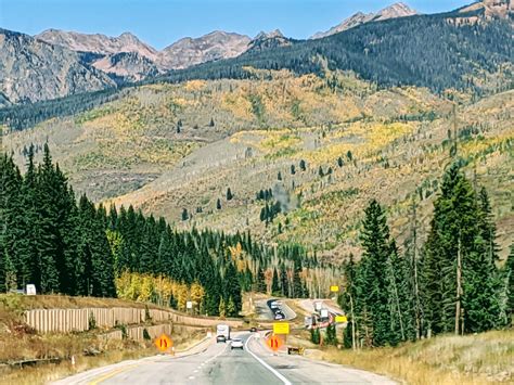
Fall Foliage: September through November
As autumn approaches, temperatures cool and the iconic fall foliage transforms the landscape.
- Average Temperatures: 50°F to 70°F (10°C to 21°C)
- Rainfall: 1-2 inches (3-5 cm) per month
- Fog: Morning fog is common in low-lying areas
Real-Time Weather Updates
Stay informed with up-to-date weather conditions through the following resources:
- Colorado Department of Transportation (CDOT) Traveler Information System: https://www.cotrip.org/
- Utah Department of Transportation (UDOT) Traffic Report: https://udottraffic.utah.gov/
- National Weather Service (NWS) Forecast: https://www.weather.gov/
Safety Tips to Remember
- Check the weather forecast before your trip and be prepared for changing conditions.
- Pack extra layers of clothing for warmth and protection from rain or snow.
- Carry an emergency kit with first aid supplies, water, and non-perishable food.
- Allow extra time for travel during inclement weather.
- Drive cautiously and increase your following distance.
- Be aware of potential road closures or detours.
Climate Change Impact
The weather patterns along I-70 are expected to change over time as a result of climate change. Projections indicate:
- More extreme weather events, including heavy rainfall and snowstorms
- Rising temperatures and more frequent heatwaves
- Increased wildfire risk
Summary Table of Average Temperatures and Precipitation
| Month | Average Temperature (°F) | Average Precipitation (inches) |
|---|---|---|
| December | -15°F to 30°F (-26°C to -1°C) | 1.5 |
| January | -10°F to 25°F (-23°C to -4°C) | 1.2 |
| February | 10°F to 35°F (-12°C to 2°C) | 1.0 |
| March | 35°F to 60°F (2°C to 16°C) | 2.0 |
| April | 45°F to 70°F (7°C to 21°C) | 2.5 |
| May | 55°F to 80°F (13°C to 27°C) | 3.0 |
| June | 70°F to 95°F (21°C to 35°C) | 1.5 |
| July | 75°F to 90°F (24°C to 32°C) | 1.0 |
| August | 75°F to 90°F (24°C to 32°C) | 1.0 |
| September | 50°F to 70°F (10°C to 21°C) | 1.5 |
| October | 40°F to 60°F (4°C to 16°C) | 1.2 |
| November | 30°F to 50°F (-1°C to 10°C) | 1.0 |
Table of Potential Weather Hazards
| Month | Potential Hazards |
|---|---|
| December through February | Snow storms, icy roads, extreme cold |
| March through May | Rain, snow, thunderstorms |
| June through August | Heatwaves, wildfires, hail |
| September through November | Fog, rain, snow |
Table of Wind Speeds and Directions
| Month | Average Wind Speed (mph) | Prevailing Wind Direction |
|---|---|---|
| December | 15-20 | West to Northwest |
| January | 15-20 | West to Northwest |
| February | 15-20 | West to Northwest |
| March | 15-20 | West to Southwest |
| April | 15-20 | West to Southwest |
| May | 15-20 | West to Southwest |
| June | 15-20 | West to Southwest |
| July | 15-20 | West to Southwest |
| August | 15-20 | West to Southwest |
| September | 15-20 | West to Southwest |
| October | 15-20 | West to Southwest |
| November | 15-20 | West to Northwest |
Table of Road Closures and Detours
| Month | Potential Closures or Detours |
|---|---|
| December through February | I-70 can be closed due to snowstorms or accidents |
| March through May | Road closures or detours due to flooding or landslides |
| June through August | Road closures or detours due to wildfires or construction |
| September through November | Road closures or detours due to snow storms or fog |
Conclusion
Navigating the weather along I-70 from Utah to Denver requires preparation and real-time information. By staying informed about the weather conditions, taking necessary precautions, and following safety tips, you can ensure a safe and enjoyable road trip.